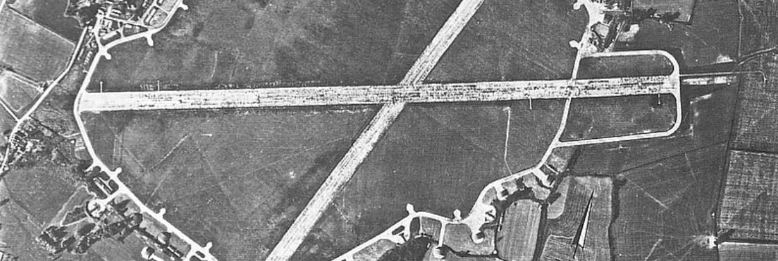
RAF Sawbridgeworth Airfield Site

Air
Landing
Ground
advanced
to
a
three
runway
airfield
mostly
by
the
intervention
and
foresight
of
II(AC)
Squadrons
Commanding
Officer
Wing
Commander Geddes.
The
buildings
remaining
on
the
airfield
form
part
of
Shingle
Hall
Farm.
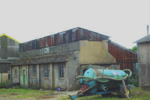
This
was
the
technical
site
of
the
airfield
where
essential
maintenance
was
carried
out.
It
was
here
that
the
Watch
Office,
T2
Hangar,
stores,
armoury
and
many
other
buildings
were
situated.
The
Watch
office
or
control
tower
was demolished in 1946, The airfields runways were all taken up in the same year to clear the land back to agriculture.
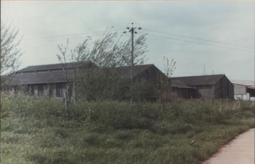
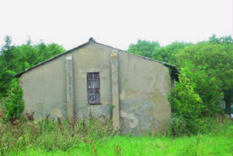
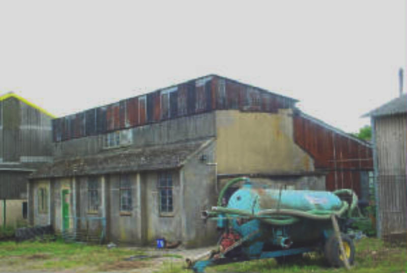
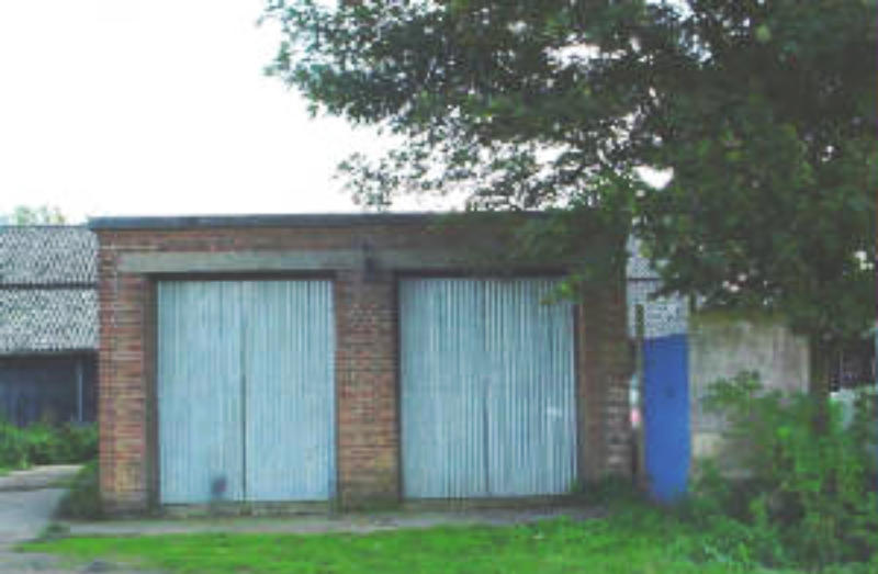
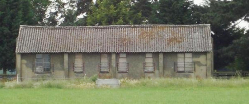
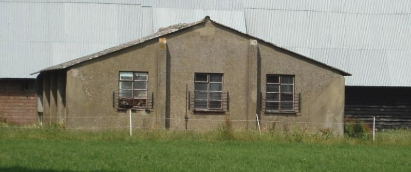
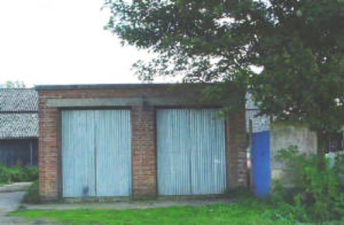
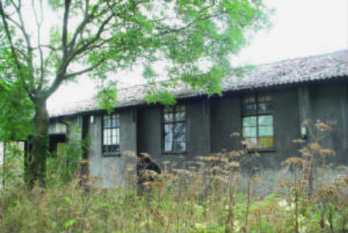
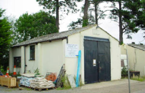
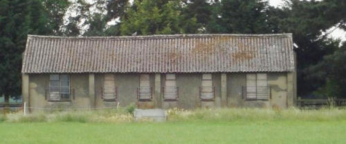
Shingle Hall Technical site has the most buildings remaining, these include the following buildings..
Fabric Store The Main Stores
Electrical Sub Station Fire Tender Shed
Parachute Store Gas Clothing and Respirator Store
Equipment Store
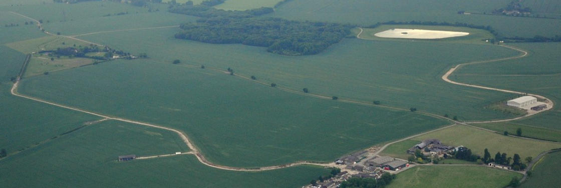
The
concrete
perimeter
track
runs
around
the
entire
airfield
site,
On
its
northern
side
it
cuts
around
the
edge
of
Mathams
Wood
and
it
is
here
that
it
retains its original full width, Mathams Wood was the name chosen to identify the ALG when the site first became operational in the First World War.
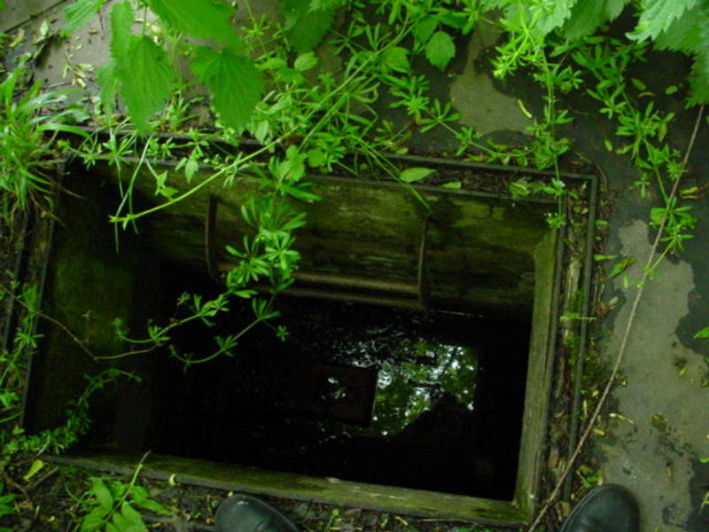
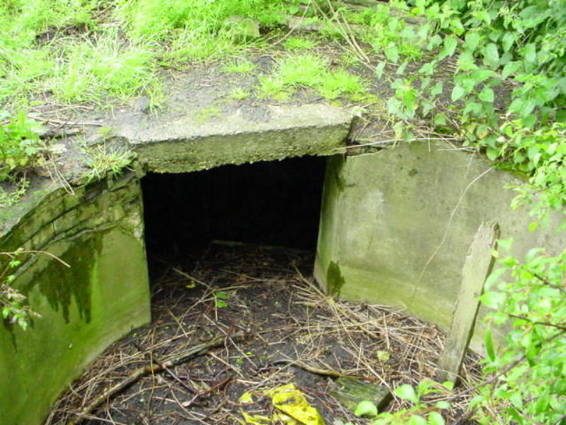
There
is
an
Ordnance
Survey
Trig
point
just
inside
the
wood,
not
far
from
this
is
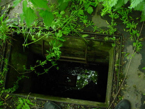
the
Battle
Headquarters,
the
underground
bunker
that
would
have
co-
ordinated
the
defences
of
the
airfield
should
it
have
came
under
attack
by
enemy
ground
forces
after
an
invasion.
The
BHQ
has
been
flooded
for
as
long as I can remember.
Around
the
outer
edge
of
the
perimeter
track
there
are
some
other
remains
of
the
airfields
defences.
A
rare
find
in
an
airfield
is
a
spigot
mortar
position.
Spigot
mortars
were
usually
a
home
guard
weapon.
It
may
be
that
because
the
local
home
guard
were
involved
with
the
defence
of
the
airfield, that it is the sole reason why such a position can be found on the site.
The
Blacker
Bombard
was
a
29mm
anti-tank
mortar
and
usually
mounted
on
a
circular
plinth
made
from
Concrete.
The
mortar
itself
was
fived
on
a
stainless steel spigot and this is how it derived its name.
Sawbridgeworths example was mounted not on a concrete plinth, but in a pit. The pit exists today on the edge of a field close to the perimeter track.
Also
to
be
found
in
the
immediate
area
are
the
filled
in
remains
of
a
line
of
defensive
brick
slit
trenches.
These
are
similar
to
those
found
at
Hunsdon.
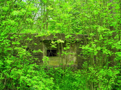
In
the
same
hedgeline
are
two
Pillboxes
and
these
are
about
200
yards
apart.
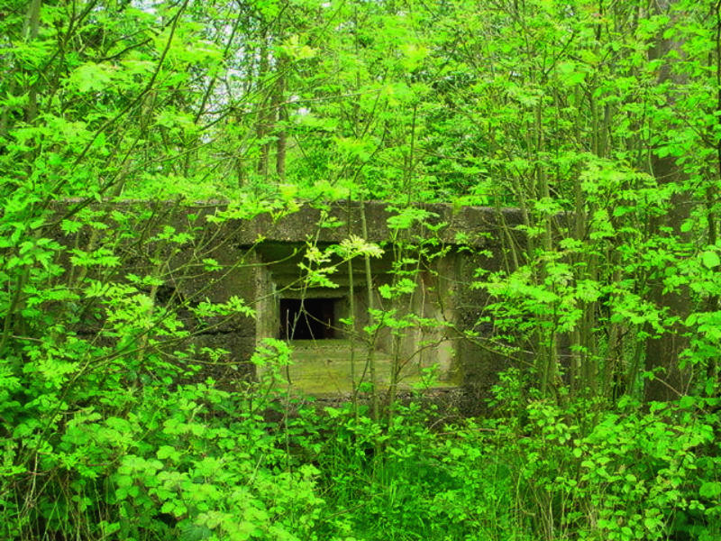
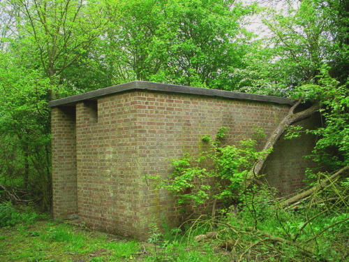
Further
pillboxes
can
be
found
near
the
Battle
HQ
in
the
treeline
and
another very near the new airfield memorial although this is hidden by dense undergrowth and is practically invisible.
Pillbox in the treeline in Mathams Wood.
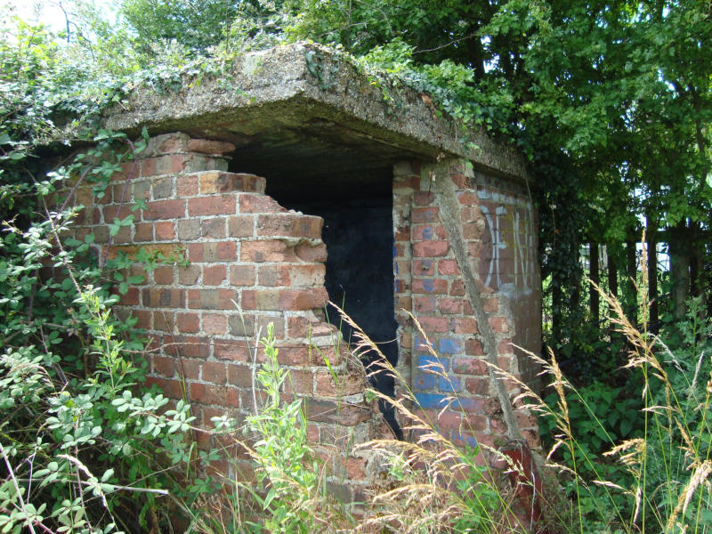
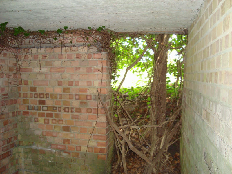
Other
small
square
shelters
are
evident.
One
just
beyond
the
pillbox
on
the
Hadham
Road,
one
on
the
road
between
Allens
Green
and
the
Hadham
road and another on the back lane that connects Beanfield Road and Sacombes Ash Lane.
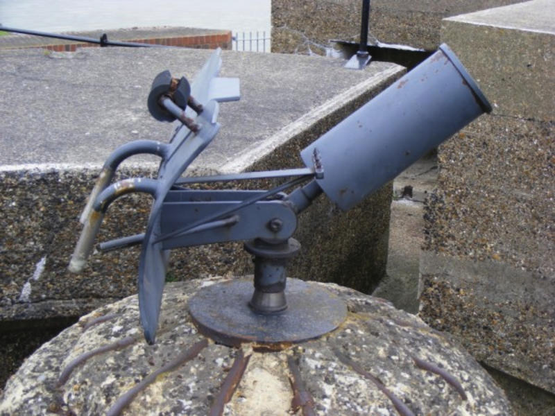
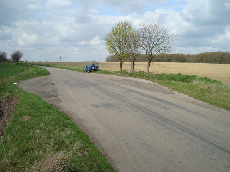
On the Hadham Road there are two small lay by's, this was once the intersection where the secondary runway crossed the
then closed Hadham Road.
There
are
four
square
shelter
type
buildings
that
are
found
only
on
the
approach
roads
to
the
airfield.
One
is
on
the
left
of
the
road
from
Allens
Green,
and
next
to
Sacombe
Ash
Lane,
the
next
is
just
past
the
modified
pillbox
on
the
Hadham
road,
Two
more
can
be
found
and
these
are
at
the
junction
with Hadham road at Trimms Green, and on the un-named track that runs from South of Trimms Green across to Sacombes Ash Lane.
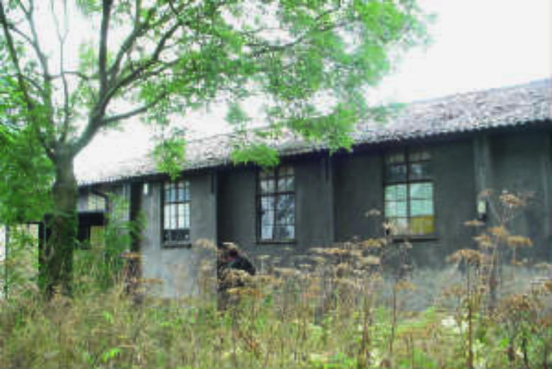
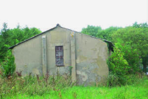
The Signals block stands in a small field next to farm buildings at the side of the drive of Shingle Hall itself.
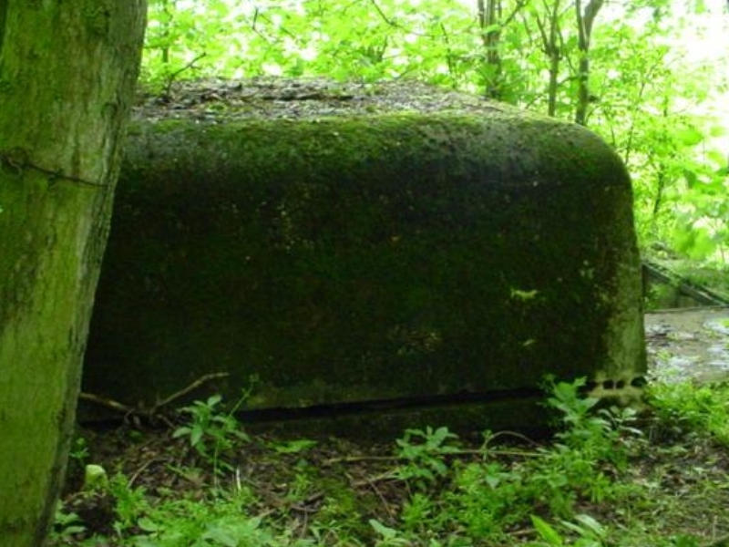
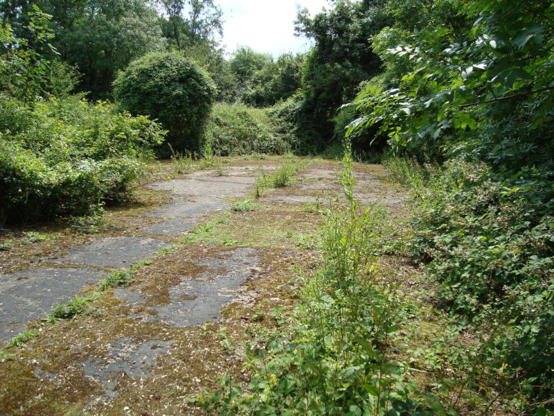
The last portion of surviving 'Blenheim' type or FCW4513 Aircraft Pen
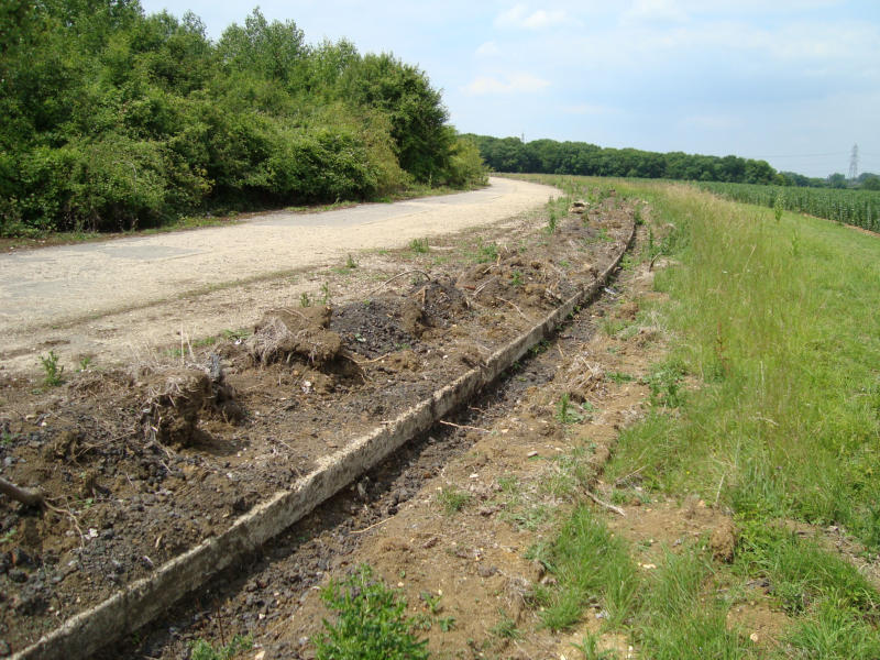
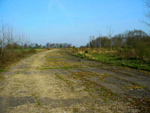
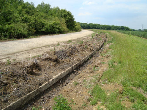
The
perimeter
track
at
Sawbridgeworth
has
always
been
a
little
on
the
rutted
side,
even
in
wartime
as
Doug
Reich
remembered.
Two
views
of
it
today, one section near Mathams and the other towards Allens Green near Blounts Farm


Wartime Airfields
rjkdesign
Wartime Airfields
rjkdesign


Wartime Airfields


Wartime Airfields

RAF Sawbridgeworth Airfield Site
Air
Landing
Ground
advanced
to
a
three
runway
airfield
mostly
by
the
intervention
and
foresight
of
II(AC)
Squadrons
Commanding
Officer
Wing Commander Geddes.
The
buildings
remaining
on
the
airfield
form
part
of
Shingle
Hall
Farm.
This
was
the
technical
site
of
the
airfield
where
essential
maintenance
was
carried
out.
It
was
here
that
the
Watch
Office,
T2
Hangar,
stores,
armoury
and
many
other
buildings
were
situated.
The
Watch
office
or
control
tower
was
demolished
in
1946,
The
airfields
runways
were
all
taken up in the same year to clear the land back to agriculture.
Shingle
Hall
Technical
site
has
the
most
buildings
remaining,
these
include the following buildings…
Fabric Store The Main Stores
Electrical Sub Station Fire Tender Shed
Parachute Store Gas Clothing and Respirator Store
Equipment Store
The
concrete
perimeter
track
runs
around
the
entire
airfield
site,
On
its
northern
side
it
cuts
around
the
edge
of
Mathams
Wood
and
it
is
here
that
it
retains
its
original
full
width,
Mathams
Wood
was
the
name
chosen
to
identify
the
ALG
when
the
site
first
became
operational
in
the
First World War.
There
is
an
Ordnance
Survey
Trig
point
just
inside
the
wood,
not
far
from
this
is
the
Battle
Headquarters,
the
underground
bunker
that
would
have
co-ordinated
the
defences
of
the
airfield
should
it
have
came
under
attack
by
enemy
ground
forces
after
an
invasion.
The
BHQ
has
been flooded for as long as I can remember.
Around
the
outer
edge
of
the
perimeter
track
there
are
some
other
remains
of
the
airfields
defences.
A
rare
find
in
an
airfield
is
a
spigot
mortar
position.
Spigot
mortars
were
usually
a
home
guard
weapon.
It
may
be
that
because
the
local
home
guard
were
involved
with
the
defence
of
the
airfield,
that
it
is
the
sole
reason
why
such
a
position
can
be found on the site.
The
Blacker
Bombard
was
a
29mm
anti-tank
mortar
and
usually
mounted
on
a
circular
plinth
made
from
Concrete.
The
mortar
itself
was
fived on a stainless steel spigot and this is how it derived its name.
Sawbridgeworths
example
was
mounted
not
on
a
concrete
plinth,
but
in
a
pit.
The
pit
exists
today
on
the
edge
of
a
field
close
to
the
perimeter
track.
Also
to
be
found
in
the
immediate
area
are
the
filled
in
remains
of
a
line
of
defensive
brick
slit
trenches.
These
are
similar
to
those
found
at
Hunsdon.
In
the
same
hedgeline
are
two
Pillboxes
and
these
are
about
200
yards
apart.
Further
pillboxes
can
be
found
near
the
Battle
HQ
in
the
treeline
and
another
very
near
the
new
airfield
memorial
although
this is hidden by dense undergrowth and is practically invisible.
Pillbox in the treeline in Mathams Wood.
Other
small
square
shelters
are
evident.
One
just
beyond
the
pillbox
on
the
Hadham
Road,
one
on
the
road
between
Allens
Green
and
the
Hadham
road
and
another
on
the
back
lane
that
connects
Beanfield
Road and Sacombes Ash Lane.
On the Hadham Road there are two small lay by's, this was once the
intersection where the secondary runway crossed the
then closed Hadham Road.
There
are
four
square
shelter
type
buildings
that
are
found
only
on
the
approach
roads
to
the
airfield.
One
is
on
the
left
of
the
road
from
Allens
Green,
and
next
to
Sacombe
Ash
Lane,
the
next
is
just
past
the
modified
pillbox
on
the
Hadham
road,
Two
more
can
be
found
and
these
are
at
the
junction
with
Hadham
road
at
Trimms
Green,
and
on
the
un-named
track
that
runs
from
South
of
Trimms
Green
across
to
Sacombes Ash Lane.
The Signals block stands in a small field next to farm buildings at the
side of the drive of Shingle Hall itself.
The last portion of surviving 'Blenheim' type or FCW4513 Aircraft Pen
The
perimeter
track
at
Sawbridgeworth
has
always
been
a
little
on
the
rutted
side,
even
in
wartime
as
Doug
Reich
remembered.
Two
views
of
it
today,
one
section
near
Mathams
and
the
other
towards
Allens
Green
near Blounts Farm


rjkdesign

rjkdesign
Wartime Airfields